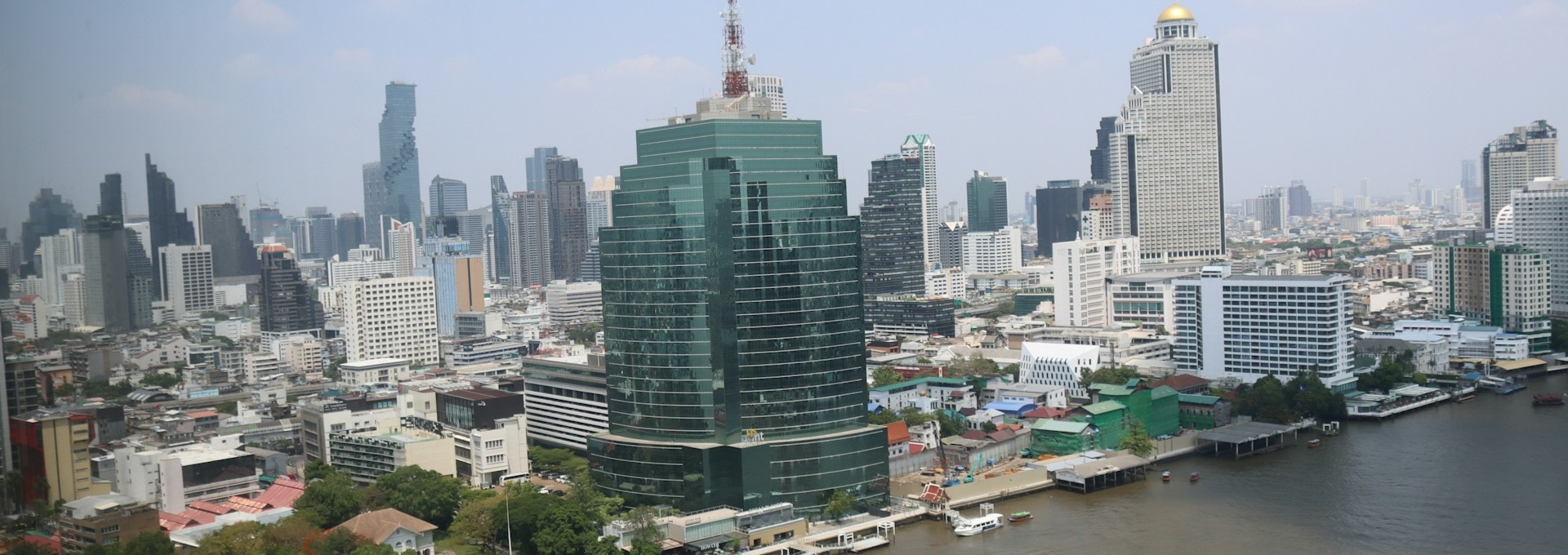
Bangkok’s September 2026 flood and the 2011 flood hit different parts of the city. A handful of neighborhoods stayed dry through both, and they’re the safest places to rent if a big flood is what worries you.
On 26 September 2026, Bangkok declared all 50 of its districts a flood disaster zone after close to 300mm of rain in two days. Three days later, the city’s own field check found that 21 of those districts hadn’t been affected at all.
Compare that with 2011, when the water came down the river from the north, and a short list of neighborhoods stayed dry both times. This guide goes through the areas expats actually look at, one by one, and rates each for big-flood risk.
One thing before you start. These ratings are about big floods only. Bangkok is still a flood-prone city, and heavy rain floods streets in every neighborhood on this list, including the safest ones.
Contents
- Key Takeaways
- What These Ratings Mean
- The Two Types of Big Flood
- Big-Flood Risk by Neighborhood at a Glance
- Lowest Risk Neighborhoods
- Low Risk Neighborhoods
- Safe From Rain, Exposed to River Floods
- Higher Risk Neighborhoods
- Is River Water a Risk This Year
- How to Check a Condo Before You Sign
- All 50 Districts
- Frequently Asked Questions
- Sources Cited
Key Takeaways
- The ratings cover big floods only. Every neighborhood in Bangkok, the safe ones included, gets flooded streets after a heavy downpour.
- Silom, Sathorn, Lumphini, Chidlom, Siam and the south side of Sukhumvit stayed dry in both 2011 and 2026.
- Thong Lo, Ekkamai, Ari and On Nut escaped 2011 but had flooded roads in 2026.
- Bang Na, La Salle and Bearing stayed dry in 2011 and were only moderately affected in 2026, but they flood often in ordinary heavy rain.
- Rama 9 is two different places. The Ratchada end had street flooding, while the Ramkhamhaeng end was among the worst-hit parts of the city.
- Western Thonburi was dry this time and badly flooded in 2011.
- Ramkhamhaeng, Lat Krabang, Min Buri, Chatuchak and Chaeng Watthana flooded in both years.
- Flooding varies street by street, even within one district, so check the soi, the ground level and the car park before you sign.


What These Ratings Mean
The ratings in this guide measure risk from big floods only, the kind that shut down a neighborhood for days or weeks, like 2011 and September 2026. They don’t mean a neighborhood never floods.
Bangkok sits 0 to 2 meters above sea level, and the BMA’s drainage chief says rainfall is now its biggest flood risk. The city’s drains are built for 80mm an hour. Anything heavier and water sits on the streets until the pumps catch up.
That happens in the safest neighborhoods too. In November 2025, a single early-morning storm dropped 111mm on Pathum Wan, the district around Siam and Lumphini, and flooded 57 spots across the city, including Rama 4, Rama 3, Khlong Toei and Sala Daeng.
The ratings are also by district, and a Bangkok district is big. Within the same district, one soi can be under water while the next stays dry, because the ground level of each street and building matters as much as the address.
Our team saw this in Rom Klao in September 2026. Some sois flooded badly, while a gated community nearby, built up higher, stayed dry. The BMA’s own notes on chronic flood spots say the same thing: many are older housing estates built on low ground, with small drains and roads that were never raised.
Good to Know: In a lowest-risk neighborhood, a heavy storm means wet feet on the way to the BTS and a slow taxi home. In a higher-risk one, a big flood can mean water on the ground floor and a soi you can’t leave for a week. Expect the first anywhere in Bangkok.
The Two Types of Big Flood
Big floods in Bangkok come from either extreme rain over the city or river water arriving from the north, and each one hits different neighborhoods. A neighborhood rated lowest risk in this guide stayed dry in both.
- Rain flood (September 2026): Close to 300mm fell in two days, on top of an already wet month (487mm from 1 to 25 September, against an average of about 269mm). The water filled the low-lying east and the streets along the big canals first. Main roads cleared in a day or two, while some low-lying housing estates were expected to need about seven days.
- River flood (2011): Months of rain in the north pushed more water down the Chao Phraya than it could carry. It reached Bangkok from Pathum Thani, Nonthaburi and Nakhon Pathom, so the north and west flooded first, and it lasted weeks. By 31 October 2011 the BMA had ordered evacuations in six districts: Don Mueang, Sai Mai, Lak Si, Bang Phlat, Thawi Watthana and Taling Chan.
The inner city stayed dry in 2011. Al Jazeera reported on 7 November 2011 that the central business district “still is dry” while floodwater reached Chatuchak, a few miles north. Residents of the outer districts protested that their homes were being sacrificed to save the centre.
| Rain flood | River flood | |
|---|---|---|
| What causes it | Extreme rain over Bangkok that the drains can’t clear | Months of rain in the north flowing down the Chao Phraya |
| Where it hits first | Low ground in the east, and streets along the big canals | The north and west edges of Bangkok, and riverside areas outside the flood wall |
| How long it lasts | Main roads a day or two; low-lying estates up to about a week | Weeks |
| Warning time | Hours (BMA radar forecasts rain about three hours ahead) | Days (the Royal Irrigation Department issues river-flow forecasts up to nine days ahead) |
| Last big one | September 2026 | October to November 2011 |
Big-Flood Risk by Neighborhood at a Glance
Silom, Sathorn, Lumphini, Chidlom, Siam, the south side of Sukhumvit, the riverside and the Old Town have the lowest big-flood risk in Bangkok, based on how they did in 2011 and 2026. Find your neighborhood in the table, then read its section below for what to watch for.
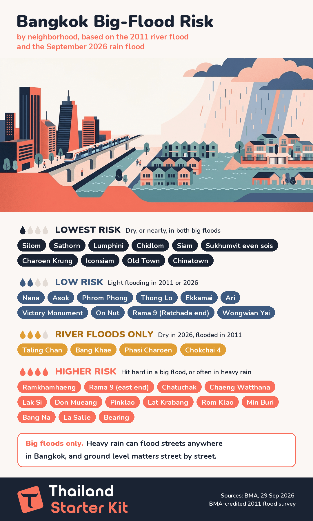
| Neighborhood | District | 2011 river flood | September 2026 rain flood | Big-flood risk |
|---|---|---|---|---|
| Silom and Sathorn | Bang Rak, Sathon | Dry or brief riverside flooding | Unaffected | Lowest |
| Lumphini, Ploenchit, Chidlom, Siam | Pathum Wan | Dry | Unaffected | Lowest |
| Sukhumvit south side (even sois, Nana to Phrom Phong) | Khlong Toei | Brief riverside flooding | Unaffected | Lowest |
| Charoen Krung, Rama 3, Iconsiam | Bang Rak, Bang Kho Laem, Yan Nawa, Khlong San | Dry or brief riverside flooding | Unaffected | Lowest (check the river wall) |
| Old Town, Khao San, Chinatown | Phra Nakhon, Samphanthawong | Brief riverside flooding | Unaffected | Lowest |
| Sukhumvit north side (odd sois, Nana to Phrom Phong) | Watthana | Dry | Moderate | Low |
| Thong Lo, Ekkamai | Watthana | Dry | Moderate | Low |
| On Nut, Bang Chak, Punnawithi | Phra Khanong | Brief riverside flooding | Moderate | Low |
| Ari, Saphan Khwai | Phaya Thai | Dry | Moderate | Low |
| Victory Monument, Pratunam | Ratchathewi | Dry | Moderate | Low |
| Rama 9 (Ratchada end), RCA, Huai Khwang | Huai Khwang, Din Daeng | Under 20% flooded | Moderate | Low |
| Wongwian Yai, Wat Arun, inner Rama 2 | Thon Buri, Bangkok Yai, Chom Thong, Bang Khun Thian | Under 20% flooded | Unaffected | Low |
| Taling Chan, Bang Khae, Phasi Charoen | Taling Chan, Bang Khae, Phasi Charoen, Nong Khaem | Whole district flooded | Unaffected | River floods only |
| Chokchai 4, Nakniwat | Lat Phrao | Over 20% flooded | Unaffected | River floods only |
| Ramkhamhaeng, Hua Mak, Rama 9 (east end) | Bang Kapi, Suan Luang | Under 20% flooded or dry | Severe | Higher |
| Chatuchak, Ratchayothin, Lat Phrao Road | Chatuchak, Wang Thonglang | Whole district flooded (Chatuchak) | Severe | Higher |
| Chaeng Watthana, Lak Si, Don Mueang | Lak Si, Sai Mai, Don Mueang | Whole district flooded | Severe (Don Mueang moderate) | Higher |
| Pinklao | Bang Phlat | Whole district flooded | Moderate | Higher |
| Bang Na, Udom Suk, La Salle, Bearing | Bang Na | Dry | Moderate | Higher (floods often in heavy rain) |
| Lat Krabang, Min Buri, Ram Intra | Lat Krabang, Min Buri, Khan Na Yao, Bang Khen | Over 20% or whole district flooded | Severe | Higher |
The 2026 column comes from the BMA’s own field check. On 29 September, the governor lifted the disaster status for 21 unaffected districts and kept it for 14 moderately and 15 severely affected ones. The BMA named the 15 severe districts when it closed their city-run schools.
The 2011 column uses a district-by-district classification credited to the BMA and published by the property site Mplushome in January 2012. It matches the BMA’s own evacuation list and news reports from the time. (Verified September 2026.)
Lowest Risk Neighborhoods
Five parts of central Bangkok stayed dry, or had only brief riverside flooding, in both the 2011 and 2026 big floods. A TDRI study confirms “the inner city of Bangkok stayed dry in 2011“.
Silom and Sathorn
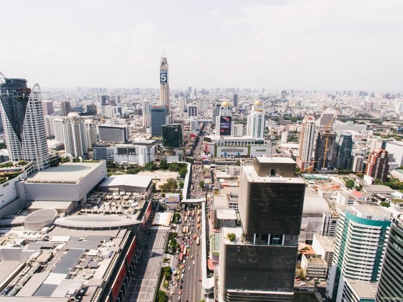
Silom and Sathorn (Bang Rak and Sathon districts) stayed dry in both big floods and are among the safest places to rent in Bangkok.
- 2011: Sathon stayed dry. Bang Rak had only brief tidal flooding along the river.
- 2026: Both districts were rated unaffected.
- Still watch for: Street flooding in heavy storms. Sala Daeng flooded in the November 2025 storm, and the BMA’s flood-risk map lists Suan Phlu Road as only partly fixed.
Lumphini, Ploenchit, Chidlom and Siam
Lumphini, Ploenchit, Chidlom and Siam (Pathum Wan district) stayed dry in both big floods, and Pathum Wan has only three points on the BMA’s flood-risk map.
- 2011: Dry.
- 2026: Unaffected.
- Still watch for: Rama 1 Road between MBK and the National Stadium, which the BMA lists as only partly fixed. Pathum Wan also took the heaviest rain of the November 2025 storm.
Sukhumvit South Side (Even-Numbered Sois)
The south side of inner Sukhumvit, the even-numbered sois from Nana to Phrom Phong (Khlong Toei district), was rated unaffected in 2026 and stayed dry in 2011, apart from brief riverside flooding.
- 2011: Only brief tidal flooding.
- 2026: Unaffected.
- Still watch for: Sukhumvit Soi 26 (BMA drainage work still in progress) and Rama 4 from Sukhumvit to Kasem Rat (only partly fixed). Khlong Toei was among the areas flooded in the November 2025 storm.
At Phrom Phong, the Emporium side is Khlong Toei and the EmQuartier side is Watthana, which is covered under Low Risk below.

Riverside: Charoen Krung, Rama 3 and Iconsiam
Riverside Bangkok along Charoen Krung, Rama 3 and Iconsiam stayed dry in both big floods, but a riverside condo is only as safe as the flood wall in front of it.
- 2011: Dry, or brief tidal flooding only. AP reported the water “briefly touched riverside areas” near Silom and Sathorn.
- 2026: Bang Rak, Bang Kho Laem, Yan Nawa and Khlong San were all rated unaffected.
- Still watch for: Gaps in the river wall. In 2024 the BMA counted 32 gaps in the Chao Phraya wall, including Rama 3 Soi 14, 38 and 56 and the Riverside Tower area in Bang Kho Laem. By September 2025, 22 were finished and 10 were still under construction.
Khlong San, around Iconsiam, carries 32 of the 120 tide-flood points on the BMA risk map, more than any other district. The Rong Si community on Rama 3 was still waiting for its permanent wall in February 2026. Ask the building office whether the lobby and car park sit behind the permanent wall.
Old Town, Khao San and Chinatown
The Old Town, Khao San and Chinatown (Phra Nakhon and Samphanthawong districts) had only brief riverside flooding in 2011 and were rated unaffected in 2026.
- 2011: Brief tidal flooding along the river.
- 2026: Unaffected.
- Still watch for: Riverside lanes. The Wang Chakraphong stretch in Phra Nakhon was one of the river-wall gaps still at the design stage in 2024.
Read more: Bangkok Apartments: Rental Prices, Best Areas, and Lease Tips
Low Risk Neighborhoods
Thong Lo, Ekkamai, Ari, On Nut, Victory Monument and the Ratchada end of Rama 9 stayed dry, or nearly dry, in 2011 and had flooded roads in 2026. The BMA rated their districts moderately affected, and its top drainage priorities were Khlong Chan and Rom Klao, further east. Several of these areas sit over the Makkasan drainage tunnel, which covers about 26 square kilometres of Watthana, Pathum Wan, Ratchathewi, Phaya Thai, Huai Khwang and Din Daeng.
Sukhumvit North Side: Nana, Asok and Phrom Phong
The north side of inner Sukhumvit, the odd-numbered sois from Nana to Phrom Phong (Watthana district), stayed dry in 2011 and was moderately affected in 2026.
- 2011: Dry.
- 2026: Moderate. The flooding reported here was mostly at the top of the sois, where New Phetchaburi Road from Makkasan to Asok was on the list of 15 flooded main roads.
- Still watch for: Sukhumvit Road from Asok to Soi 71 and Asok Montri Road, both listed by the BMA as only partly fixed. A condo near Sukhumvit Road is a safer bet than one at the Phetchaburi end of a long soi.
Thong Lo and Ekkamai
Thong Lo and Ekkamai (Watthana district) stayed dry in 2011, but Ekkamai was one of seven spots the city told small cars to avoid in September 2026.
- 2011: Dry.
- 2026: Moderate. The city’s 26 September warning named Ekkamai (Sukhumvit Soi 63), and Phetchaburi Road at Thong Lo and Ekkamai was flooded.
- Still watch for: The northern ends of both sois, near Phetchaburi. The BMA lists Sukhumvit Soi 65 and 71 as only partly fixed.
On Nut, Bang Chak and Punnawithi
On Nut, Bang Chak and Punnawithi (Phra Khanong district) had only brief riverside flooding in 2011 and were moderately affected in 2026. Addresses around BTS Phra Khanong and On Nut can fall in Khlong Toei, Watthana, Phra Khanong or Suan Luang district, so check the khet.
- 2011: Brief tidal flooding only.
- 2026: Moderate. Water came up through the drains as the city pumped canal water toward the river, which the governor called temporary backpressure. On Nut Road from Sukhumvit 77 to On Nut 17 was on the flooded-roads list.
- Still watch for: Going deeper down On Nut Road. Past the Sukhumvit end, it runs into Suan Luang and Prawet, which were among the 15 severely affected districts.
Ari and Saphan Khwai
Ari and Saphan Khwai (Phaya Thai district) stayed dry in 2011 and were moderately affected in 2026.
- 2011: Dry.
- 2026: Moderate. Phahonyothin Road between Saphan Khwai and Ari flooded on 26 September.
- Still watch for: That same stretch of Phahonyothin, which the BMA still lists as only partly fixed.
Victory Monument and Pratunam
Victory Monument, Pratunam and Makkasan (Ratchathewi district) stayed dry in 2011 and were moderately affected in 2026.
- 2011: Dry.
- 2026: Moderate. Nearby Din Daeng Road and Phetchaburi Road from Makkasan were on the flooded-roads list.
- Still watch for: Street flooding in heavy storms. Ratchathewi had the second-heaviest rain in the November 2025 storm.
Rama 9 (Ratchada End), RCA and Huai Khwang
The Ratchada end of Rama 9, around MRT Phra Ram 9, Central Rama 9, Fortune Town and RCA (Huai Khwang and Din Daeng districts), was under 20% flooded in 2011 and moderately affected in 2026.
- 2011: Partly flooded, under 20% of each district.
- 2026: Moderate. The stretch from the Rama 9 intersection to Central Rama 9 and RCA was on the city’s list of 21 flooded routes to avoid on 26 September. On 27 September, Phetchaburi Road outside Singha Complex was under 29.9cm of water.
- Still watch for: Ratchada at Thiam Ruam Mit, where BMA drainage work is still in progress. Two big drainage tunnels, Makkasan and Saen Saep–Lat Phrao, serve this area.
Tip: Rama 9 Road runs all the way east to Srinakarin, and the far end is a very different story (see Ramkhamhaeng and Rama 9 East below). Check the district on the listing: Huai Khwang or Din Daeng means the Ratchada end, and Suan Luang or Bang Kapi district means the Ramkhamhaeng end. Many RCA addresses say “Bang Kapi” only because that’s also a subdistrict inside Huai Khwang.
Wongwian Yai and Inner Thonburi
Wongwian Yai, Wat Arun and inner Rama 2 (Thon Buri, Bangkok Yai, Chom Thong and Bang Khun Thian districts) were only partly flooded in 2011 and unaffected in 2026.
- 2011: Partly flooded, under 20% of each district.
- 2026: Unaffected. On 26 September the Bangkok Post reported the governor as saying there were no flooding problems in western Bangkok.
- Still watch for: Riverside lanes outside the wall, and street flooding in heavy storms.
Safe From Rain, Exposed to River Floods
Western Thonburi and Lat Phrao district came through the September 2026 rain flood untouched but were badly flooded in 2011, when the water came from the north and west. They’re a reasonable bet in ordinary rainy seasons. If the Royal Irrigation Department starts warning about river levels in October or November, keep an eye on it.
Taling Chan, Bang Khae and Phasi Charoen
Taling Chan, Bang Khae, Phasi Charoen and Nong Khaem in western Thonburi were unaffected in 2026 but flooded district-wide for a long stretch in 2011.
- 2011: Whole districts flooded. The BMA warned of water pouring in from Nonthaburi and Nakhon Pathom, and Taling Chan was evacuated.
- 2026: Unaffected. Khaosod English reported the Thon Buri side had “relatively few problems“.
- Still watch for: Phetkasem Road near Seacon Bang Khae, which flooded in an October 2022 downpour.
Chokchai 4 and Nakniwat (Lat Phrao District)
Lat Phrao district, around Chokchai 4 and Nakniwat, was over 20% flooded in 2011 and unaffected in 2026, but it has 39 rain-flood points on the BMA map, the second-most of any district.
Don’t confuse it with Lat Phrao Road, which flooded from the Ratchada intersection to Bang Kapi in 2026 (see Higher Risk below).
Read more: Living in Bangkok Suburbs: The Complete Expat Guide
Higher Risk Neighborhoods
Bangkok’s east and north flooded worst in September 2026, and most of these neighborhoods also flooded in 2011. Bang Na is here for a different reason: its big-flood record is mild, but it floods often in ordinary heavy rain. On 28 September, Lat Krabang and Khan Na Yao had 30,000 to 40,000 flood victims each, and about 700,000 people were affected citywide.
The east was planned as the city’s flood outlet. After the 1983 flood, the King’s Dyke was built to protect the centre, and a green belt in Lat Krabang and Min Buri was set aside as a floodway. Housing has since spread into it, and the retention areas have shrunk from 92,000 rai to about 34,000 rai.
Ramkhamhaeng and Rama 9 East
Ramkhamhaeng, Hua Mak and the eastern end of Rama 9 toward Srinakarin (Bang Kapi and Suan Luang districts) were among the 15 severely affected districts in 2026.
- 2011: Bang Kapi was partly flooded (under 20%), and Suan Luang stayed dry.
- 2026: Severe. Ramkhamhaeng 24 (Hua Mak Road) was still impassable for small vehicles on 29 September, and in the Khlong Chan flats residents couldn’t wade through “chest-deep floods to go to work“. Srinakarin and Phatthanakan Road were on the flooded-roads list, and the city was delivering meals to 30 blocks of flats at Khlong Chan.
- Still watch for: Sinking ground. In 2015, Ramkhamhaeng Road had the highest subsidence rate in Bangkok, about 2cm a year.
Chatuchak, Ratchayothin and Lat Phrao Road
Chatuchak, Mo Chit, Ratchayothin, Kasetsart and the length of Lat Phrao Road flooded in both big floods.
- 2011: Chatuchak was flooded district-wide, and floodwater reached the Chatuchak market area while the centre stayed dry.
- 2026: Severe. Vibhavadi Rangsit flooded from Chatuchak through Lak Si to Don Mueang, and Lat Phrao Road flooded from the Ratchada intersection to Bang Kapi. Soi Sena Nikhom had 59cm of water on 27 September, the deepest reading in the BMA’s report that day.
Chaeng Watthana, Lak Si and Don Mueang
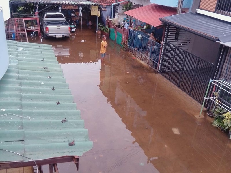
Chaeng Watthana, Lak Si, Sai Mai and Don Mueang in the far north were evacuated in 2011 and flooded again in 2026.
- 2011: Among the first six districts the BMA ordered evacuated, by 31 October.
- 2026: Lak Si and Sai Mai were severe, and Don Mueang was moderate. Chaeng Watthana Road flooded from Lak Si to the expressway, and on 29 September the governor was still watching Sai Mai for water spilling over from Pathum Thani.
Pinklao and Bang Phlat
Pinklao and Charan Sanitwong (Bang Phlat district) were evacuated in the 2011 river flood and moderately affected in 2026.
- 2011: Flooded district-wide.
- 2026: Moderate.
- Still watch for: The river. Bang Phlat has 21 tide-flood points on the BMA map, the second-most after Khlong San, and several of its river-wall gaps were unfinished in 2024.
Lat Krabang, Min Buri and Ram Intra
Lat Krabang (the Suvarnabhumi side), Rom Klao, Min Buri, Khan Na Yao around Fashion Island and outer Ram Intra carry the highest big-flood risk in Bangkok.
- 2011: Lat Krabang, Min Buri and Khan Na Yao were each over 20% flooded, and Bang Khen was flooded district-wide.
- 2026: Severe. The BMA made Khlong Chan and Rom Klao–Lat Krabang its top drainage priorities, and some low-lying communities were expected to need about a week to drain.
- Still watch for: Slow drainage. Water from Lat Krabang has to travel down Khlong Prawet Burirom, and the governor said the canal’s many bends slow the flow. The BMA map lists 38 flood points in Lat Krabang, 16 of them not fully fixed.
Flooding here varies street by street. In Rom Klao, some sois were badly flooded while gated estates built on higher ground stayed dry, so judge the specific project, not just the area.
Bang Na, La Salle and Bearing
Bang Na district, including Udom Suk, La Salle and Bearing, stayed dry in 2011 and was only moderately affected in 2026, but it floods often in ordinary heavy rain and has more unfinished flood points on the BMA map than any other district.
- 2011: Dry.
- 2026: Moderate. Sukhumvit from Bang Na to Udom Suk was on the list of roads to avoid, and Bang Na-Trat Road flooded in its outbound parallel lanes from the Bang Na intersection. Just past Bearing, Samut Prakan had 260,784 households affected and eight deaths, the highest death toll of any province as of 29 September.
- Heavy rain, not just big floods: On 15 September 2026, ten days before the big storm, ordinary heavy rain flooded all three lanes of Srinakarin Road in Samut Prakan, right up to the Bang Na border at La Salle. In October 2022, one afternoon downpour flooded Bang Na, La Salle and Bearing deep enough to stall traffic.
- Still watch for: The BMA lists 28 flood points in Bang Na, 21 of them not fully fixed. Most are older housing estates off La Salle (Soi 22, 24 and 32), Bearing Soi 19, Udom Suk 58 and the Bang Na-Trat sois, which the BMA describes as low-lying with small drains that flood whenever it rains.
Near Sikarin Hospital on La Salle, the drains can’t empty into Khlong Bang Na when the canal is over its banks. A high-rise with raised parking near the BTS is a better bet than a house in one of the older villages, but Sukhumvit Road itself floods at the Bang Na intersection.
The Nong Bon drainage tunnel, which serves On Nut, Udom Suk and Sukhumvit, is due to be fully running in 2026. Wait for a rainy season or two of results before counting on it.
Is River Water a Risk This Year
Northern water is rising, but on 29 September 2026 Bangkok’s governor said upstream flow of about 2,000 cubic metres per second was still within the city’s flood defences. The river walls stand about 3m above mean sea level, and the highest tide that day was forecast at about 2m. (Verified September 2026.)
The Royal Irrigation Department then raised releases from the Chao Phraya Dam from 2,000 to 2,200 cubic metres per second. It warned 11 provinces, including Bangkok, that river levels could rise 20 to 60cm over 24 hours.
For renters, the exposure is riverside homes outside the permanent wall, not the inner city. If you live near the water, the ThaiWater site shows live river levels.
How to Check a Condo Before You Sign
You can check a specific Bangkok condo for flood risk by looking up its district, finding its street on the BMA flood-risk map and asking the building what happened in September 2026. Do it even in a lowest-risk neighborhood, since every part of Bangkok has streets that flood.
- Find the district: Look for the khet on the listing, the lease or Google Maps, and find it in the district table below.
- Check the BMA flood-risk map: The BMA dashboard plots all 737 known flood points with their repair status. A point marked partly fixed or in progress on your soi is a warning sign.
- Watch it rain: During a downpour, the BMA’s road flood sensors show live water depths, and Traffy Fondue shows residents’ flood reports.
- Check the ground level: Compare the building’s entrance, lobby and car park with the road outside. A project built up above the street can stay dry while older houses on the same soi flood.
- Ask the building office: Did water reach the lobby or car park in September 2026? Does the building have pumps or a flood barrier? Where did residents move their cars?
- Walk the soi: Look for water stains on walls, shopfronts raised on steps and sandbags stacked by doors. Ask the street vendors, who know which stretch floods and for how long.
- Skip the ground floor in higher-risk areas: A high floor keeps your unit dry. Basement parking and ground-floor units are where the damage happens.
In the expat forums, the most consistent advice is to check the soi between your building and the main road. A dry condo isn’t much help if you can’t get out to the BTS for three days.
Read more:
- What to Check Before Signing a Rental Contract
- Bangkok Floods 2026: Cleanup, Health Risks, and How to Claim Compensation
All 50 Districts
Eleven of Bangkok’s 50 districts stayed dry, or had only brief riverside flooding, in both the 2011 river flood and the September 2026 rain flood. The table rates every district for big-flood risk, so you can look up any address.
| District | Neighborhoods you’ll know | 2011 river flood | September 2026 rain flood | Big-flood risk |
|---|---|---|---|---|
| Pathum Wan | Siam, Chidlom, Ploenchit, Lumphini, Langsuan | Dry | Unaffected | Lowest |
| Sathon | Sathorn, Suan Phlu, Saint Louis | Dry | Unaffected | Lowest |
| Khlong San | Iconsiam, Khlong San riverside | Dry | Unaffected | Lowest |
| Rat Burana | Suksawat | Dry | Unaffected | Lowest |
| Pom Prap Sattru Phai | Wat Saket, Worachak | Dry | Unaffected | Lowest |
| Bang Rak | Silom, Sala Daeng, Surawong, upper Charoen Krung | Brief riverside flooding only | Unaffected | Lowest |
| Khlong Toei | Even-numbered Sukhumvit sois (south side), Rama 4, Queen Sirikit Centre | Brief riverside flooding only | Unaffected | Lowest |
| Yan Nawa | Rama 3, lower Chong Nonsi | Brief riverside flooding only | Unaffected | Lowest |
| Bang Kho Laem | Rama 3, lower Charoen Krung, Asiatique | Brief riverside flooding only | Unaffected | Lowest |
| Phra Nakhon | Old Town, Khao San, Grand Palace | Brief riverside flooding only | Unaffected | Lowest |
| Samphanthawong | Chinatown (Yaowarat) | Brief riverside flooding only | Unaffected | Lowest |
| Watthana | Odd-numbered Sukhumvit sois (north side): Nana, Asok, Phrom Phong, Thong Lo, Ekkamai | Dry | Moderately affected | Low |
| Phaya Thai | Ari, Saphan Khwai, Sanam Pao | Dry | Moderately affected | Low |
| Ratchathewi | Victory Monument, Pratunam, Makkasan | Dry | Moderately affected | Low |
| Bang Na | Bang Na, Udom Suk, La Salle, Bearing, BITEC | Dry | Moderately affected | Higher (rain floods) |
| Thung Khru | Pracha Uthit | Dry | Moderately affected | Low |
| Dusit | Dusit, Samsen | Brief riverside flooding only | Moderately affected | Low |
| Phra Khanong | On Nut, Bang Chak, Punnawithi | Brief riverside flooding only | Moderately affected | Low |
| Bang Sue | Bang Sue, Tao Poon | Brief riverside flooding only | Moderately affected | Low |
| Huai Khwang | Rama 9 (Ratchada end), Ratchada, RCA, Thiam Ruam Mit | Partly flooded (under 20% of the district) | Moderately affected | Low |
| Din Daeng | Din Daeng, Rama 9 intersection | Partly flooded (under 20% of the district) | Moderately affected | Low |
| Thon Buri | Wongwian Yai | Partly flooded (under 20% of the district) | Unaffected | Low |
| Bangkok Yai | Wat Arun, Itsaraphap | Partly flooded (under 20% of the district) | Unaffected | Low |
| Chom Thong | Wutthakat, inner Rama 2 | Partly flooded (under 20% of the district) | Unaffected | Low |
| Bang Khun Thian | Outer Rama 2 | Partly flooded (under 20% of the district) | Unaffected | Low |
| Taling Chan | Taling Chan, Borommaratchachonnani | Whole district flooded for a long stretch | Unaffected | River floods only |
| Bang Khae | Outer Phetkasem, Bang Khae | Whole district flooded for a long stretch | Unaffected | River floods only |
| Phasi Charoen | Inner Phetkasem | Whole district flooded for a long stretch | Unaffected | River floods only |
| Nong Khaem | Nong Khaem | Whole district flooded for a long stretch | Unaffected | River floods only |
| Bangkok Noi | Wang Lang, Siriraj, Arun Amarin | Partly flooded (over 20% of the district) | Unaffected | River floods only |
| Lat Phrao | Chokchai 4, Nakniwat | Partly flooded (over 20% of the district) | Unaffected | River floods only |
| Wang Thonglang | Middle Lat Phrao Road, Pradit Manutham | Dry | Severely affected | Higher (rain floods) |
| Suan Luang | On Nut Road, Phatthanakan, Srinakarin, Rama 9 (east end) | Dry | Severely affected | Higher (rain floods) |
| Bang Kapi | Ramkhamhaeng, Hua Mak, Khlong Chan, Rama 9 (Ramkhamhaeng junction) | Partly flooded (under 20% of the district) | Severely affected | Higher (rain floods) |
| Bueng Kum | Seri Thai, Nawamin | Partly flooded (under 20% of the district) | Severely affected | Higher (rain floods) |
| Chatuchak | Mo Chit, Ratchayothin, Kasetsart, Sena Nikhom | Whole district flooded for a long stretch | Severely affected | Higher |
| Bang Khen | Inner Ram Intra, Bang Khen | Whole district flooded for a long stretch | Severely affected | Higher |
| Lak Si | Chaeng Watthana, Government Complex | Whole district flooded for a long stretch | Severely affected | Higher |
| Sai Mai | Sai Mai, Saphan Mai | Whole district flooded for a long stretch | Severely affected | Higher |
| Khlong Sam Wa | Khlong Sam Wa | Whole district flooded for a long stretch | Severely affected | Higher |
| Min Buri | Min Buri, Suwinthawong | Partly flooded (over 20% of the district) | Severely affected | Higher |
| Lat Krabang | Lat Krabang, Rom Klao, Suvarnabhumi side | Partly flooded (over 20% of the district) | Severely affected | Higher |
| Prawet | Prawet, Nong Bon | Partly flooded (over 20% of the district) | Severely affected | Higher |
| Khan Na Yao | Outer Ram Intra, Fashion Island | Partly flooded (over 20% of the district) | Severely affected | Higher |
| Saphan Sung | Outer Ramkhamhaeng, Rat Phatthana | Partly flooded (over 20% of the district) | Severely affected | Higher |
| Nong Chok | Nong Chok | On BMA alert list; final extent not published | Severely affected | Higher |
| Don Mueang | Don Mueang, Vibhavadi (north) | Whole district flooded for a long stretch | Moderately affected | Higher |
| Bang Phlat | Pinklao, Charan Sanitwong | Whole district flooded for a long stretch | Moderately affected | Higher |
| Thawi Watthana | Thawi Watthana, Phutthamonthon Sai 2 | Whole district flooded for a long stretch | Moderately affected | Higher |
| Bang Bon | Ekkachai | Partly flooded (over 20% of the district) | Moderately affected | Higher |
Tip: Go by the district (khet) on the lease or on Google Maps, not the road name. Long roads like Rama 9, Lat Phrao and On Nut cross several districts with very different flood records.
Frequently Asked Questions
Is Anywhere in Bangkok Flood-Free?
No neighborhood in Bangkok is flood-free. The city sits 0 to 2 meters above sea level, and heavy storms flood streets even in Pathum Wan, Silom and Sukhumvit. What differs is how deep the water gets and how long it stays, which depends on the district and on how high your street and building sit.
Is Sukhumvit Safe From Floods?
Inner Sukhumvit, from Nana to Ekkamai, stayed dry in the 2011 big flood and got street flooding in September 2026, mostly at the Phetchaburi end of the northern sois. The south side (Khlong Toei) was rated unaffected. Further out, On Nut was moderately affected, On Nut Road deep into Suan Luang was hit hard, and Bang Na, La Salle and Bearing flood often in ordinary heavy rain.
Will Bangkok Flood Like 2011 Again?
Experts at a Senate seminar in May 2026 warned that Bangkok could face another major flood between 2030 and 2034 if water management doesn’t improve. On rain floods, the governor warned in September 2026 that a 300mm storm could come back, whether later this year or in 10 years.

Does Living on a High Floor Protect You?
A high floor keeps your unit dry, but it doesn’t protect your car or your commute. In September 2026 the BMA used boats, jet skis and high-clearance trucks to get meals to buildings deep inside flooded sois. The neighborhood and the soi matter more than the floor.
Are the BTS and MRT Affected by Floods?
The BTS, MRT and Airport Rail Link kept running through the September 2026 floods. The problem was getting to the stations. The Department of Rail Transport said several roads under the rail lines had deep standing water.
Read more: Thailand’s Monsoon and Flash Flood Season: A Safety Guide for Expats
Sources Cited
- Government Public Relations Department (prd.go.th), 29 September 2026: BMA proclamation ending the disaster in 21 districts; 29 districts remain (14 moderate, 15 severe).
- Thai PBS World, 30 September 2026: English list of the 29 districts still under the disaster declaration.
- Thai PBS, 29 September 2026: BMA school closures in the 15 severely affected districts.
- Mplushome, January 2012 (“50 เขตในกรุงเทพรอดจากภาวะน้ำท่วมใหญ่ ปี 2554”): BMA-credited classification of all 50 districts in the 2011 flood.
- BMA announcement, 31 October 2011 (via ReliefWeb): 2011 evacuation districts, water from Nonthaburi and Nakhon Pathom, western roads flooding.
- Al Jazeera, 7 November 2011: central business district dry while floodwater reached Chatuchak.
- TDRI, post-2011 flood walls paper: inner city stayed dry in 2011.
- IDE-JETRO: King’s Dyke after 1983, green belt floodway in Lat Krabang and Min Buri.
- The Nation, 30 May 2026: “three waters”, 0 to 2m elevation, 80mm-per-hour drainage capacity, rain radar, 2030 to 2034 flood warning.
- The Nation, 29 September 2026: seven-day drainage estimate, Phra Khanong backpressure, 2,000 cubic metres per second within capacity, 3m walls and 2m tide, Sai Mai watch, food deliveries into flooded sois.
- The Nation, 28 September 2026: Khlong Prawet Burirom drainage, Khlong Chan tunnel, 300mm storm could recur.
- The Nation, 26 September 2026: seven spots closed to small cars (including Ekkamai) and 21 flooded routes (including Rama 9 to RCA).
- Bangkok Post, 26 September 2026: 15 flooded main roads, no flooding in western Bangkok.
- Bangkok Post, 27 September 2026: flood depths including Singha Complex and Sena Nikhom.
- Bangkok Post, 28 September 2026: victims by district.
- Bangkok Post, 29 September 2026: roads still impassable, including Ramkhamhaeng 24; chest-deep water at Khlong Chan.
- Malay Mail (AFP), 26 September 2026: September rainfall against the 1991 to 2020 average.
- Khaosod English, 26 September 2026: Thon Buri side had relatively few problems.
- Khaosod English, 29 September 2026: areas still flooded.
- TAT Newsroom, 29 September 2026: BTS, MRT, Airport Rail Link and Red Line operating.
- Thansettakij, 26 September 2026: flooding on roads under rail lines.
- MGR Online (AFP), 1 November 2011: inner Bangkok dry, outer districts protesting.
- Thai PBS World, 30 September 2026: Chao Phraya Dam release raised to 2,200 cubic metres per second.
- BMA flood-risk dashboard: 737 flood points, repair status, and point counts by district.
- The Standard, 2 September 2024: 32 gaps in the river wall, 4.35km.
- Bangkok Biz News, 11 September 2025: 22 wall gaps finished, 10 under construction.
- Thansettakij, 21 February 2026: Rong Si community, Rama 3, still awaiting a permanent wall.
- Fox News (AP), October 2011: water briefly touched riverside areas near Silom and Sathorn.
- Asia News Network, October 2022: Phetkasem Road near Seacon Bang Khae flooded in a downpour.
- The Nation, 25 September 2026: Bang Na-Trat Road parallel lanes flooded.
- Thai Post (DDPM summary), September 2026: Samut Prakan households affected and deaths by province.
- Bangkok Biz News, 15 September 2026: Srinakarin Road flooded to La Salle in heavy rain.
- Daily News, 3 October 2022: Bang Na, La Salle and Bearing flooded in a downpour.
- Asia News Network, November 2025: 57 flooded locations including Rama 4 and Sala Daeng; 111mm in Pathum Wan.
- Asia News Network (The Nation), September 2025: eastern retention areas shrinking from 92,000 to 34,000 rai.
- Bangkok Post, June 2015: subsidence rates on Ramkhamhaeng Road and in Lat Krabang.
- Thaipublica, March 2023: drainage tunnels and the districts they serve.
- MGR Online, 2026: Nong Bon drainage tunnel in full operation in 2026.